
GIS modelling reveals hotspots of soil erosion in Kongwa, Tanzania
Soil erosion by water and wind is a major threat to agriculture in communities living in semi-arid areas in central Tanzania. Despite the significant efforts by private and public entities to control soil erosion, the problem persists in Kongwa District of Dodoma region.
Recently, Darren Abraham Mbaga, from Ardhi University, Tanzania, carried out research to quantify soil erosion and sediment yields in the semi-arid district.
His interest in the problem was from his passion for supporting farmers. ‘I have witnessed farmers suffering due to soil erosion. I thought of finding a solution to this pressing challenge, and I believe the maps generated will be useful in suggesting control measures for the problem to improve farm yields,’ he said.
The study was part of Mbaga’s fourth-year dissertation for his bachelor’s degree in Geoinformatics at the university.
Studies like Mbaga’s are important in gathering in-depth information that guides researchers to practical solutions for soil erosion. His research focused on a small-scale (narrow research study) for in-depth analysis of the problem in the area and more accurate results.
He used the Revised Universal Soil Loss Equation (RUSLE) to estimate the potential soil losses and sediment yield by utilizing rainfall, soil, Normalized Difference Vegetation Index (NDVI), and Digital Elevation Model (DEM) datasets to arrive at valid conclusions.
‘These models are more accurate, detailed, and more precise for modelling soil erosion compared to other models,’ he said. Moreover, the validation of results using high-resolution satellite images showed the results from the revised RUSLE model were reasonably accurate,’ he stressed.
The study uncovered sparse vegetation cover, severe runoff, soil type, and steep slopes-accelerated soil erosion in Kongwa District and produced a sediment yield map of the entire district. The results showed annual soil loss of 66.24 tons/ha/year, sediment yield of 13.58 t/ha/year and generated maps showing the model inputs such as the vegetable cover, slope, soil types, annual rainfall, and effect of agricultural management practices on the potential of soil erosion. The maps identified the hotspots for soil erosion that should be prioritized for soil and water conservation measures such as planting trees, cover crops, and construction of physical barriers such as gabions. ‘The maps will support decision-making, particularly for sustainable control or reduction of soil erosion. They will support land management to improve food security in my country,’ noted Mbaga.
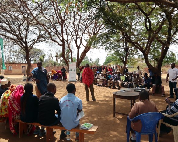
Kongwa District is among the Africa RISING action sites in Tanzania. In this area, the project worked with farmers to tackle soil fertility decline and land degradation.
‘I am glad I worked in areas where the Africa RISING project initiatives are implemented. This idea came from Francis Muthoni, my mentor from the International Institute of Tropical Agriculture (IITA) when I was pursuing my internship program,’ said Mbaga.
Africa RISING uses geographic information system (GIS) tools and remote sensing to ensure the appropriate agricultural technologies are applied at a suitable place and to the right people.
‘Mbaga’s maps will complement Africa RISING research on spatial targeting of soil and water conservation in Kongwa, noted Muthoni.
His research was supervised by Dorothea Deus from the Geospatial Department at Ardhi University and IITA and supported by the United States Agency for International Development (USAID)-funded Africa RISING project, which is led by IITA.